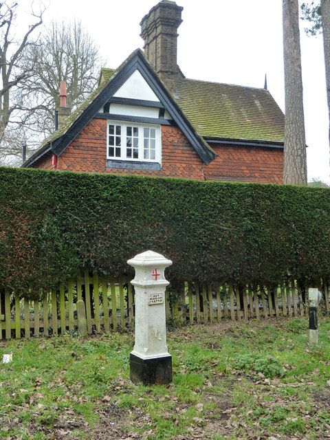
Coal duty marker, Potter Street Hill
Drag the round handle to slide between the old map (left) and today (right). On a phone, tap the map once to move it.
Then
Coal brought into the London area was taxed, and at first posts marked a boundary about 20 miles from the General Post Office in the City. An Act of 1861 cut the area back to the Metropolitan Police District, and this post marked its edge. It is a white-painted cast-iron post of 1861, made at Henry Grissell's Regent's Canal Ironworks. Posts of this kind are the commonest in south Hertfordshire, and this one is a square pier about one and a half metres high with bevelled corners, a pyramid top and the City of London's crest just below the cap. A raised panel on the front is lettered Act 24 and 25 Vict. Cap 42, the Act of Parliament behind the coal duty boundary. The duty ended in 1889, but many of the posts survived.5,46,47,48,292
Now
It was listed Grade II on 3 October 1985, and the list entry describes it as partly buried. It still stands on the county boundary where Sandy Lane meets Potter Street Hill. Another listed coal duty marker, a cast-iron obelisk, stands on the same county boundary beside the railway near Little Oxhey Lane.
Position from OpenStreetMap. See Sources and method.