South Oxhey was once farmland and wood. In 1872 the whole estate was offered for sale, and the printed particulars, which list every farm, cottage and field, are the best picture we have of the land before the houses.20 The estate's woods, from Oxhey Woods to the small springs on the playing fields, have their own page, The old woods.
Oxhey Hall
Historic England dates Oxhey Hall, on Hampermill Lane, to the early 1500s, with a richly carved oak ceiling of 16 panels.178 The dry moat, about 102 by 60 metres, is a scheduled monument. The scheduling text repeats a story that Henry VIII used the house for hunting, but gives no evidence.186 A timber barn of around 1700 nearby is listed Grade II.179,283
The 1872 particulars called Oxhey Hall "a capital farm residence", partly moated and lately enlarged. They singled out its drawing-room ceiling of carved timber as a rare early piece of English domestic building.20
Hamper Mill, which shares the lane's name, appears in an undated Hertfordshire Archives photograph on Our Oxhey. It was a water-powered paper mill, also called Souche's Mill.284
In the Second World War the farmhouse held the Lucy Gaster Children's Home, which took in displaced and refugee children. Its matron was Rose Lucy Gaster, and the Jewish Chronicle of 3 November 1944 carried a notice of a few vacancies there for children aged two to seven.103,285 One woman who was sent there as an infant remembers the farmhouse staircase, a pigpen, the chickens, a garden she never forgot and underground air raid shelters.285
Accounts of the home differ sharply. The same woman remembers kindness, and a matron who wrote to her every year until she died. Another former child, there from 1944 to 1946, remembers it as a brutal place. A researcher working on the Kindertransport found the matron's letters about one child in her care unsympathetic.285,286 Other contributors say the house had been used for unmarried mothers before the war and that the matron ran a home for unmarried mothers after it, and that a housekeeper lived in a cottage in the grounds which the older children had to clean. A local farmer whose family took the farm on after the war told a local historian that it had been a children's home under Lucy Gaster well before their time.286
This is the one farmhouse that survives. It has been listed Grade II* since 3 October 1985,178 and the old farm buildings have been turned into a house.179,283
Oxhey Lodge and Oxhey Warren
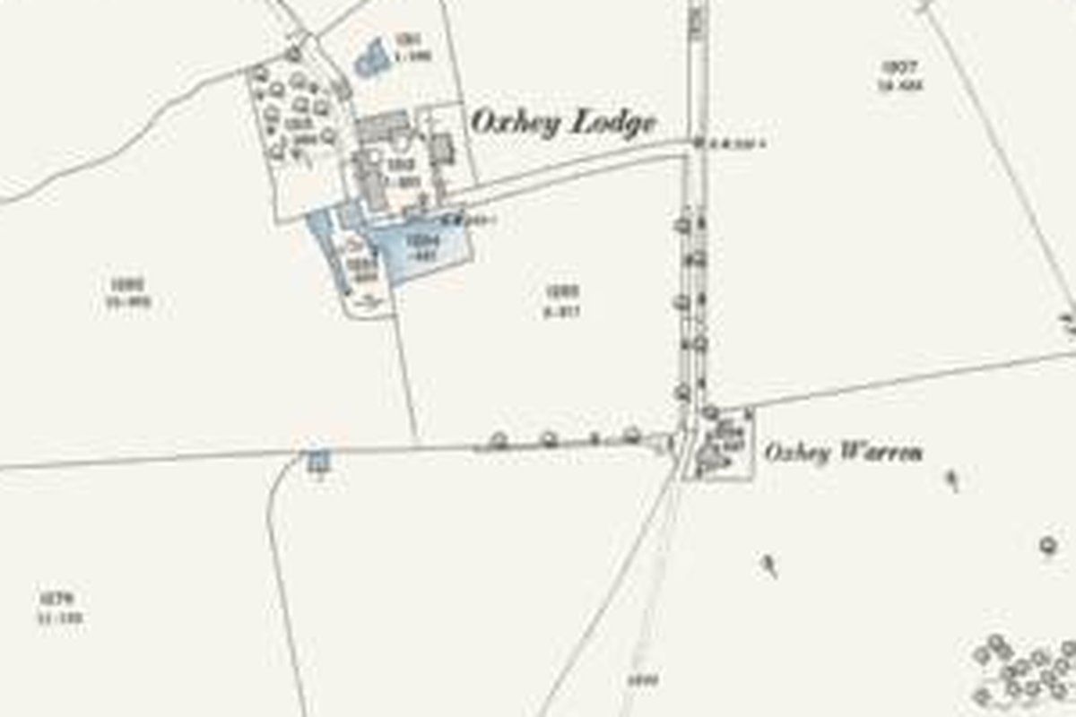
Oxhey Lodge is older than the farm. In 1601 part of the estate was sold with its warren ground and the warren lodge "called Edeswick or Oxhey Lodge".18 John Swain says the lodge had cottages and outbuildings, reached by a short track from Green Lane at the northern entrance to the Blackwells' estate, and that it is marked on sheet 7 of the Ordnance Survey Old Series of 1822.40 The county's landscape study dates the lime avenue at Oxhey Warren to parkland of around 1820.287 By 1872 Oxhey Lodge was a 153-acre farm with its house "on the Hanging looking to the Railway", three barns, stabling for ten cart horses and room for 18 cows. Its fields included Kiln Field, Pond Meadow, Sand Pit Field and Shoulder of Mutton Meadow. The tenant of Oxhey Hall had agreed to take it on as well.20
Between the farm and Oxhey Place lay The Warren, a 53-acre pasture on the Oxhey Place home farm, with a new lodge of red brick and tiles at its gate, built by W. H. Smith.18,20 Maps from 1896 to the 1960s show a small house called Oxhey Warren at the fork of Green Lane, south of the farm. It stands where a gate lodge would, but no source says it was the same building.58,90,165 The maps revised in 1896 and in 1912 to 1913 show Oxhey Lodge and Oxhey Warren as separate buildings, and the second of them also prints "Golf Club" beside Oxhey Warren.58,59 The council's plan treats the two names as one.13
In 1924 the sons of Samuel John Blackwell sold Oxhey Lodge Farm with parts of two other farms, and that land became the 1930s Oxhey Hall estate.82 The deed also recorded rights of way along Green Lane to the golf clubhouse and to Oxhey Warren.82 A photograph of Oxhey Lodge taken in 1928 survives at Watford Library, and readers noted that the building looks almost identical to the park keepers' cottages that once stood in Oxhey Park.40
Because of that sale, when the London County Council drew its boundary in 1943, the farmhouse was left just outside, while the clubhouse and Oxhey Warren were inside.21 Swain places Oxhey Lodge a little over 100 yards north-west of the clubhouse and says it stood until the late 1950s, though he was not sure of the date.40 Its site is now under Highlands, and a short road there called Oxhey Lodge keeps the name.5,58,288 The researcher who worked through the deeds puts the farm near Highlands too, and says a couple of houses there could have been farm cottages.82
The chalk pit
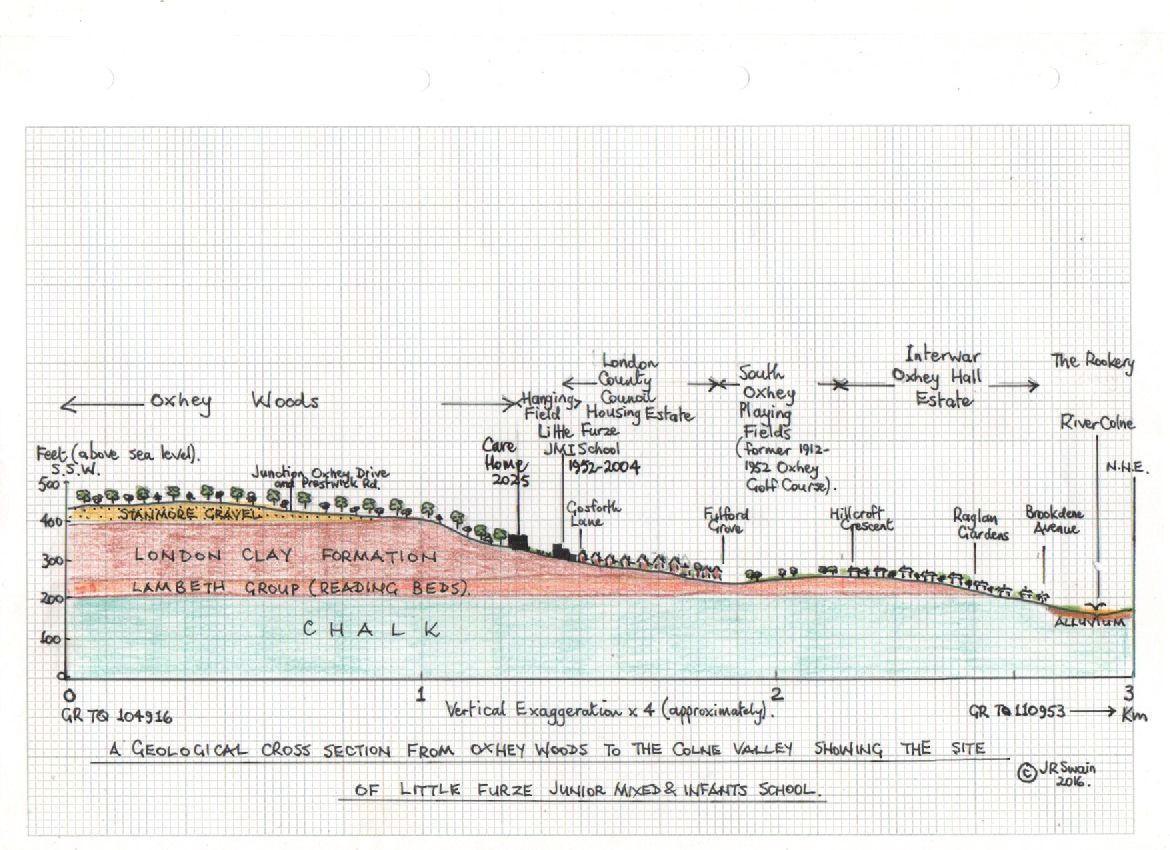
A deep, steep-sided pit lies on the north-west side of Big Wood, on the northern edge of the playing fields.12,13 The council calls the pit medieval.13 Swain, who has written about the geology here, takes it to be medieval in origin with the digging for gravel, sand and chalk carrying on into the Victorian era, which is not the contradiction it first looks.12,289 The Ordnance Survey map of 1872, surveyed in 1871, already showed one chalk pit here and a second marked as old.50 The pit was the hazard on the short 15th hole of the early course. Swain calls the hollow Nelson's Drop, the name he knew it by as a boy on the estate in the 1950s.12
A safety note about the pit is on the Visit and look for page.
The estate in 1872
W. H. Smith, who had bought Oxhey in 1866, put it up for auction on 3 July 1872. The main lot came to 1,094 acres in five holdings, the individual figures rounded to the nearest acre. The owner kept 274 acres of woods, plantations and nurseries in his own hands. The rest was let as four farms: Oxhey Place with Ranger's Farm (383 acres), Oxhey Lodge (153 acres), Oxhey Hall (258 acres) and the small Gate House Farm (25 acres).18,20
The particulars did their best to tempt a buyer. The woods were "famous for woodcock", laid out with drives and walks, and a large sum had lately gone on new nurseries and young trees. The timber and nursery stock alone were valued at £10,000, to be paid on top of the price. The land was hunted by the Old Berkeley Hounds, with fishing in the Colne. There were views to St Albans Abbey, Windsor Castle and Harrow-on-the-Hill. The farms were said to be well watered, with ponds "never known to fail". The railway ran along the eastern edge, with London a little over half an hour away.20
The auction does not seem to have sold the estate. The copy of the particulars reproduced in Poor But Proud has handwritten additions from after 1872, and Smith sold the remainder to Thomas Blackwell in 1877. His family's story is on the Oxhey Place page.18,20
Our Oxhey carries a six-inch Ordnance Survey map of 1899 from Hertfordshire Archives that shows the same ground before the estate, with Oxhey Place and Oxhey Lodge named and the woods filling much of the sheet. A local historian reading it identifies the old park pond as the site of Oxhey Wood School and Pond Wood as the wood now behind the police station.290
Oxhey Place and Ranger's Farm
The home farm stood between the old walled garden and the chapel. In 1872 it had a four-bedroom farmhouse, an entrance lodge, six cottages, barns, a granary on stone piers and stabling for eight cart horses. One cottage had once been a dove cote, and a field nearby was called Dove House Field. The tenant was Thomas Blackwell, five years before he bought the whole estate.18,20 Foley, writing in 1889, passed a pretty farmhouse and a huge barn, with the chapel standing alone in a field beyond.57
Where Ranger's Farm stood is not recorded. The name may be a surname, like many of the field names here, or a memory of a ranger of the old deer park.20
The 1935 Ordnance Survey map shows the farmhouse about 130 metres west of the chapel. By the 1960s the farmhouse site was under the houses of Lincoln Drive and Matlock Crescent.5,90,165
The timber yard at Paddock Spring
The woods kept in hand in 1872 included a timber yard, sawpit and workshop, with two cottages listed next to them.20 Neil Hamilton places the yard at Paddock Spring, the way into the woods from Gosforth Lane beside the cadet huts. He says two old cottages still stood there in the 1950s, and one served as the estate's first police station.141
Gate House Farm
Gate House Farm, "near Pinner Hill", was the smallest holding. It had a three-bedroom house with a dairy and a well, a small barn, a stable and a piggery, let at a very low rent. Its fields included Middle and Upper Frog Hall.20 A local-history gazetteer says it stood on the county boundary by Sandy Lane and was pulled down in 1905.62 The building at that corner on the 1890s map is labelled only as a lodge, so the exact site is still uncertain.291,292
The field names
The particulars name every field. The Oxhey Place farm had The Hangings, Great and Little Dingley's, Hammond's Slough, Oak and No Man's Field, The Black Park and Great Bird Field. Oxhey Hall had Lime Kiln Dell, Thistley Field and the Hither, Middle and Further Worthies.20
"Hanging" is an old word for a steep slope. The Hangings was a field of nearly 9 acres, poor pasture with woods on three sides, and Little Furze School opened on it and the ground beside it in 1952, a site of 13 acres.20,135 The school has gone, and new streets there are called Hangers Wood Way and Little Furze Road.135,293,294
Park Pond, a large pond with stepped banks, lay just west of Pond Wood, on ground now used by Oxhey Wood Primary School. Pond Wood itself survives.20,295,296,297 A local historian on Our Oxhey reads the pond's square, regular shape on the old maps as a made feature, probably stocked with fish, a short walk from Oxhey Place and the chapel, and the natural place for water off the higher ground of Oxhey Woods to gather.296 Frederick Goodall's etching of 1878 shows cattle watering there, with the Oxhey Place farmhouse and the chapel behind.274,296
The ground remembers the pond. After a freak downpour in the 1980s, with the drains blocked by leaves, water ran off the woods through the gardens of Oakdale Road to the old hollow and flooded part of Oxhey Wood School. A contributor remembers children swimming in the dip by the boiler house, the head teacher being called out over the weekend and the fire brigade pumping the boiler house out.296 The school's secretary of more than thirty years says the ground by the Key Stage 2 playground is always damp, even in a hot summer, and that repeated investigations never found the reason.296
Otherwise very little survives. The council estate's roads were named after golf courses, so none takes a field name. Broadfields Lane, off Hampermill Lane, probably echoes Oxhey Hall's Broad Field, though how it was named is not recorded.20,82,298 The 1872 farms also had fields called Ox Pasture and Ox Pastures, which may be where Ox Pasture Spring on the playing fields got its name.20
Little Oxhey Farm
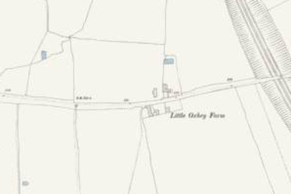
Little Oxhey Farm is not in the 1872 sale. The map of the mid-1890s names Little Oxhey Farm on Little Oxhey Lane, just west of the railway.20,291 In 1935 its buildings stood on the south side of the lane, about where Lytham Avenue now joins it.299
A resident remembers a white gate where Little Oxhey Lane ended, the farm entrance to the Blackwell estate. The dairyman at Oxhey Lane rented the field beyond it from the estate, and the resident rode hay carts through the gate in the school holidays in the 1940s.300
The Little Oxhey farmhouse was almost certainly the building that housed the estate's first library from 1951, which Shops, pubs and services follows.125,299
Oxhey Bridge Farm and Broadfields
Another farm name turns up in the deeds and nowhere else. The mortgage schedule of 1910 lists an Oxhey Bridge Farm among Samuel John Blackwell's holdings, alongside Oxhey Lodge, Oxhey Hall and Broadfield, and part of it went with the 1924 sale. The deeds give no clue where Oxhey Bridge Farm stood.82
Broadfields House was kept out of that sale, but Broadfields Lane went with it, and who owns the lane was still unclear when a Sure Start centre was built near its foot in the 2000s.82
The dairy farm at Oxhey Lane
The nearest working farm to the new estate was over the railway in Oxhey Lane, a dairy trading as S. A. Brazier and later as Carpenders Park Dairies.102 It stood next to a farm belonging to the owner of Oxhey Grange, which the dairyman later bought from him.102 A local historian who knew the place says the farm had stood for more than 300 years, and that the house fronting the road is younger, from the 1860s, most likely the agent's house for the Carpenders estate opposite.102
The rounds went out from the yard with horses in the war and with three-wheel and four-wheel electric floats later on.102 Estate families walked up the cinder track and along the lane to it, and in the early years, before the estate had shops, the milkman was how many of them got their groceries.102 The dairy's shop was a walk-in pantry off the farmhouse, served through a hatch, with a second hatch added when more people started buying there. The shelves held bread, biscuits, bacon, eggs, yoghurt and sweets, much like a corner shop.102
The war reached the farm. A V1 flying bomb fell on 27 July 1944 at the bottom of the field beside the orchard, on the ground where a flood storage reservoir for the Hartsbourne stream was later built, opposite what is now the entrance to Carpenders Park lawn cemetery.102 Families who had left London to get away from the bombing were living in the orchard in those years, one in a touring caravan and one in a shepherd's hut. The caravan family stayed until 1952.102
A wartime scheme also put pigs in the field by the railway bank near Carpenders Park station, run by the same dairyman with a butcher. Swill bins went into every road on the neighbouring estate, the waste was cooked in a hopper beside the sties, and the pigs were taken to a Watford abattoir when the Ministry of Food allowed it.301 The pig farm outlasted the war by many years, kept by a family who lived on the site in a caravan, and people waiting for trains could hear and smell the pigs.301
The same historian photographed every farm and dairy building before they came down.102