The lost golf course
A loop round South Oxhey Playing Fields, the ground of Oxhey Golf Club from 1912, past its old woods, the chalk pit of the famous short hole and the council's information board about the old course.
Start: Green Lane car park, by the Pavilion. Route: a loop with 9 stops. Underfoot: Mown grass and rough paths, muddy in winter. Stay back from the edge of the chalk pit.
Google Maps shows every stop in its app or on a computer. In a phone's web browser it can leave stops out, so follow the map on this page or use the GPX file.
The route follows paths and pavements where they exist, and goes straight across open grass where they don't. Paths are drawn from OpenStreetMap, so check the ground as you go.
- 1
The Pavilion
The old golf clubhouse beside Green Lane. A clubhouse stood here from 1912. After the golf stopped it became The Pavilion, a pub and restaurant, which closed in 2018. Read more →
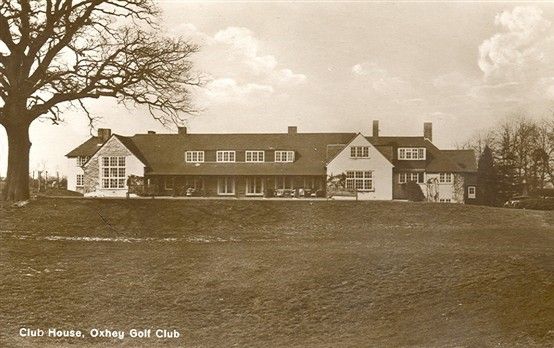
Old postcard: the Club House, Oxhey Golf Club. Bill the Brit, via Wikimedia Commons (CC BY-SA 4.0) - 2
Site of Oxhey Lodge
Oxhey Lodge farm stood a little north-west of the clubhouse, very probably on the site of the old warren lodge of 1601. John Swain remembers it standing until the late 1950s. Read more →
- 3
The levelled east end
The new estate took the east end of the course in 1946, and this lower ground was levelled for pitches in the 1950s. South Oxhey parkrun starts close by on Saturday mornings. Read more →
- 4
Ox Pasture Spring
A strip of old hornbeam coppice with an ancient wood bank on its south side. The council calls it the best old coppice on the fields. Read more →
- 5
Big Wood
Named on the maps of the 1890s and now on Natural England's revised list of ancient woodland. Read more →
- 6
Nelson's Drop
The deep old chalk pit on the north-west side of Big Wood, the hazard on the famous short hole of the original course. Look from the edge only. Read more →
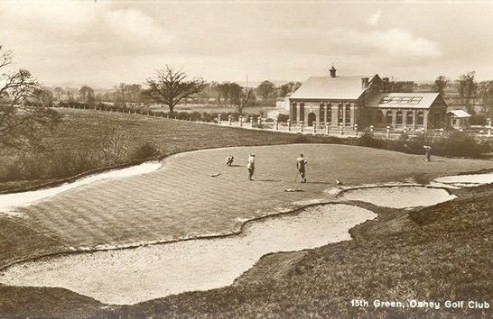
Old postcard: the 15th green, the short hole over Nelson's Drop. Bill the Brit, via Wikimedia Commons (CC BY-SA 4.0) - 7
Hampermill Wood
Another small ancient wood at the west end of the fields. Tee boxes of the later course could still be seen near here in 1964. Read more →
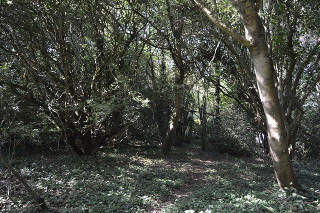
Inside Hampermill Wood on the playing fields in 2018, one of the small woods now on Natural England's revised ancient woodland list. © N Chadwick, Geograph (CC BY-SA 2.0) - 8
Round Spring and Hampermill Spring
Two old woods named on the 1896 map. Both survive, and in 2025 they were among the woods given village green protection. Read more →
- 9
Ashburnham Drive entrance
The council's information board with the plan of the 1920 course stands at this entrance, where the London LOOP leaves the fields. Head back east across the grass to the start. Read more →