The 1920 plan
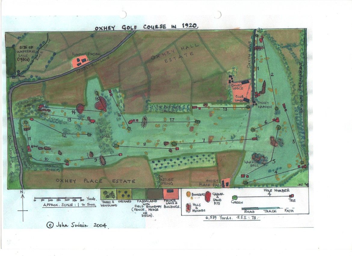
A clean redraw of John Swain's plan of the course as it was about 1920. Drag and zoom, tap a hole, or fade in the photo of the council board to compare.
Oxhey Golf Course in 1920: key
6,539 yards · S.S.S. 78
Approx. scale 1 to 5,000
Tap any hole on the plan to read about it.
Where the plan comes from
John Swain drew this plan in 2004, and gave us permission to publish it in September 2026. He grew up on the estate, at the police house in Hayling Road from 1953, and drew the course partly from memory and partly from plans printed in the club's brochure of 1939, which were supplied by the golf historian Don Dunham, who died in 2022 and whose maternal grandfather, Sid Baker, was the club's head greenkeeper.
The redraw above is ours, traced from the plan as it appears on the council board at the playing fields, and fitted to today's ground. The plan gives the course as 6,539 yards with a standard scratch score of 78.