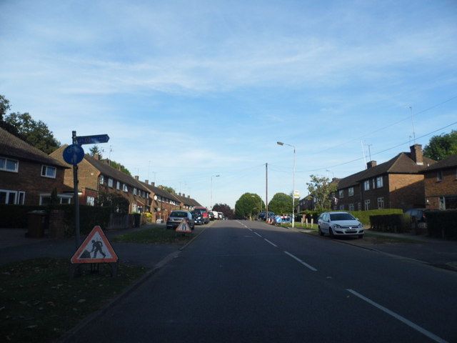
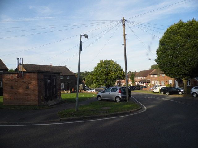
Hayling Road
Named after Hayling Golf Club, founded in 1883, on Hayling Island, Hampshire, England.
The 1896 map shows what was here before the estate. Drag the round handle to compare it with today.
The name
Hayling Road takes its name from Hayling Golf Club. The club was founded by the Sandeman port and sherry family, its links were lengthened by J.H. Taylor in 1905 and reshaped by Tom Simpson from 1931.
Where the club's facts come from: Club History, Hayling Golf Club, the club's own history.
How sure we are of the match: Strong
The estate's streets were named after golf courses. The streets page explains how each match was made.
In the story
- Oxhey Golf Club: The end of the club
John Swain reckons the estate took more than a quarter of the playing area. On Our Oxhey he puts it at about 30 per cent, saying that building Hayling Road and Prestwick Road cost about that share of the lower, eastern end of the links, between Green Lane and the railway embankment, so the course had to be redesigned and was no longer of championship length. - Hole 4
The hole ran west-south-west from Prestwick Road, across ground now covered by Ralston Way and Puttenham Close, to a green in what are now the Colnbrook School grounds off Hayling Road. - Hole 5
The tee was at the edge of Hayling Road beside Colnbrook School. - Hole 9
The hole ran west, 50 to 60 metres in from the Hayling Road and Ashburnham Drive houses, to a green just north-west of the Ashburnham Drive entrance. - Building the Estate: The plan
As built, four main roads carried the estate: Prestwick Road, Hayling Road, Oxhey Drive and Gosforth Lane, with many short closes opening off them. - Life on the Estate: Clubs, carnivals and sport
For the Coronation in June 1953 street committees threw children's parties with films, Punch and Judy and souvenir cups, and the carnival of 1957, held in August or October as the sources differ, paraded from Hayling Road to a fairground on the edge of the old golf course. - Schools: Warren Dell, the first school
For the estate's fiftieth anniversary in 1998 children at Warren Dell School wrote poems and songs about the old walnut tree in Hayling Road, danced round it and fed it orange juice. - Churches: The Salvation Army hut
A Salvation Army hut stood on the corner of Hayling Road and Gosforth Lane. - Shops, pubs and services: Hallowes Crescent, from 1951
John Swain's family moved into the police house in Hayling Road on 28 February 1953, and he remembers the shops already giving the impression of having been up and running for some time. - Getting about: Buses
A family who moved to Hayling Road in 1950 had a five-minute walk to Sandy Lane for the unreliable 345, later renumbered 347, which went to Watford or Northwood. - Clubs, sport and events: The Cow Shed and the community centres
A charabanc outing to Southend set off from the Submarine Club in the 1960s, and one of the men on it says that when the club was demolished a new working men's club was built near the shops at the top of Hayling Road. - Change and renewal: South Oxhey today
The estate also reaches into Oxhey Hall and Hayling ward, which takes in Hayling Road, and Carpenders Park ward, which takes in streets such as Woodhall Lane, so no single figure covers it all. - Rebuilding the centre: Planning permission
Countryside applied in January 2016 for up to 458 homes on the centre and homes on three smaller "satellite" sites: open space at Maylands Road, the site of the Jet pub on Hayling Road and the old services club at Hallowes Crescent. - The playing fields: Sport and play on the fields
The player who joined Oxhey Cricket Club in 1957 says its pitch was on the Prestwick Road side of the ground at one time and on the Hayling Road side at another, and he could no longer remember which came first. - Visit and look for: Getting there
Route 328 runs roughly hourly along Hayling Road, including at weekends, and stops at Colnbrook School, the nearest stop to the parkrun start. - Hayling Road, the first homes
In November 1947 the first tenants, a couple from Paddington, were given the keys to a Hayling Road house with three bedrooms and a kitchen big enough to eat in. - Walks
756 Seventeen people came on the first health walk, which crossed Hayling Road onto the playing fields, went through a small wood, passed the Pavilion and came back along Prestwick Road. - Warren Dell Primary School
Poor But Proud's timeline says Colnbrook School opened in the old infants' buildings on Hayling Road in 1964. - Colnbrook School
The map of the 1890s names Warren Dell, a small wood north of today's Hayling Road, and Our Oxhey says the name came from the many rabbits in the area. - The Jet (site)
The Jet opened in 1959 on Hayling Road at the corner of Holmside Rise, where the 1960s Ordnance Survey marks a pub.
On the timeline
- November 1947 The first tenants of the new South Oxhey estate move into Hayling Road.
- 5 March 1952 Two bus services begin, the 346 between Kingswood and Hayling Road and the 346A between Kingswood and Ormskirk Road.
- 1957 The South Oxhey Carnival parades through the estate, and the sources disagree about the month. Our Oxhey dates it to August, with a procession from Hayling Road to a fairground on the edge of the old golf course, where the Carnival Queen is crowned. Poor But Proud puts it in October, with a parade of floats that starts and ends at Oxhey Pavilion and closes Carnival Week.
- 1 July 1959 Oxhey Woods are sold to Hertfordshire County Council for £26,000. The Jet pub opens in Hayling Road the same year.
- mid 1960s The Salvation Army hut on the corner of Hayling Road and Gosforth Lane closes, and it stands empty for years before housing is built on the site.
- 22 March 1999 A walnut tree about a century old, said to have been planted by the Blackwells, falls across Hayling Road.
- 2011 The Jet pub in Hayling Road is demolished, and Three Rivers launches the South Oxhey Initiative.
Close by
Buildings
- The Jet (site) 90 m
- South Oxhey Baptist Church 220 m
- Oxhey Woods Local Nature Reserve 230 m
- Estate timber yard, Paddock Spring 270 m
- Little Furze School (site) 300 m
Ancient woods
- Ox Pasture Spring (by Gosforth Lane) 30 m
- Oxhey Woods, northern part (Old and Young Hangings, Little Furze Field, The Plantation) 230 m
- Big Wood 340 m
Walk stops
- Site of The Jet 90 m
Streets of 1947 to 1953 walk - Blairhead Drive 160 m
Streets of 1947 to 1953 walk - Harewood Road 240 m
Streets of 1947 to 1953 walk
Distances are in a straight line from a point on the street.