St Andrew's precinct (site)
Drag the round handle to slide between the old map (left) and today (right). On a phone, tap the map once to move it.
Then
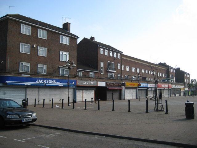
The estate's central shopping centre dates from the 1950s. The Three Rivers Museum Trust says it opened in 1952, although Poor But Proud dates the start of work to 1953. Its main shops were on St Andrew's Road, which was later closed to traffic to make a pedestrian precinct. Locals called it the big shops, with Sainsbury's, Woolworths, the Co-op and Boots below flats, and a regular market. A Boots the Chemist assistant of 1961 remembers her shop standing between Sainsbury's and Lipton's, with a wet fish shop, a record shop, bakers and a gents' outfitters along the same block. In June 2009 the parade ran from Jacksons to Homecraft by way of Wimpy and the empty Woolworths, and by 2011 Boots had closed and the Peace Hospice shop had taken its unit.5,23,25,119,165,211,234,374,462,725
Now
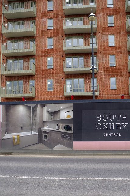
It was demolished in stages from 2018 for South Oxhey Central, and new blocks of flats now stand where it was. Oxhey Library holds photographs of the road in the 1990s, and one of it before it was closed to traffic.
Mentioned in
- Change and renewal: Right to buy, and harder times Renewal
- Rebuilding the centre: Why the centre was rebuilt Renewal
- Visit and look for: Where to find more Visit
Position from old Ordnance Survey maps and OpenStreetMap. See Sources and method.