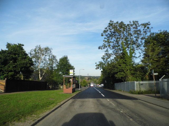
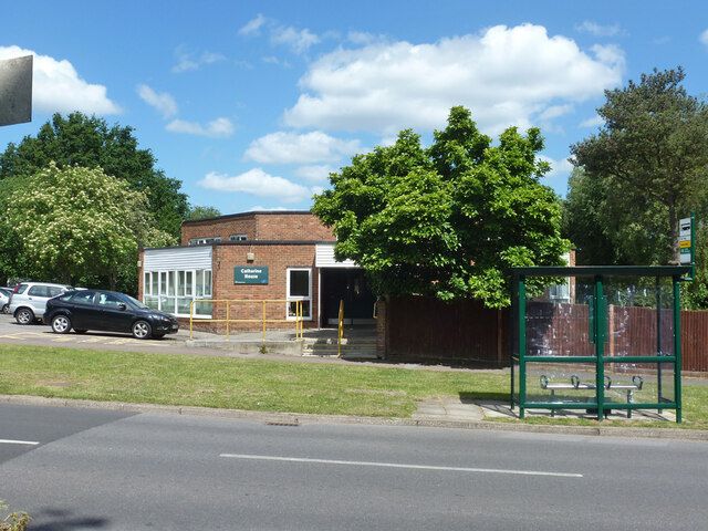
Gosforth Lane
Probably named after Gosforth Golf Club, founded in 1906, in Gosforth, Newcastle upon Tyne, England.
The 1896 map shows what was here before the estate. Drag the round handle to compare it with today.
The name
Gosforth Lane probably takes its name from Gosforth Golf Club. It began as a nine-hole course on land leased from the Laycock Estates.
Where the club's facts come from: Some History, Gosforth Golf Club, the club's own history.
How sure we are of the match: Likely
The estate's streets were named after golf courses. The streets page explains how each match was made.
In the story
- Oxhey Place and its first two houses
In 1604 the lawyer James Altham bought the estate. His house cost £3,000 and stood with its garden and orchard inside a brick wall enclosing 5 to 7 acres. In 1612 he built Oxhey Chapel, which still stands in Gosforth Lane and is listed Grade II*. - Farms and fields: The timber yard at Paddock Spring
Neil Hamilton places the yard at Paddock Spring, the way into the woods from Gosforth Lane beside the cadet huts. - The old woods: Oxhey Woods, part by part
Paddock Spring is the name used locally for the corner of the northern woods entered from Gosforth Lane, beside the air training corps and army cadet huts. - Oxhey Chapel: The 1963 appeal
Gladys Wray's article in Hertfordshire Countryside asked readers to send contributions to the vicar at All Saints' Vicarage in Gosforth Lane. - The 1943 Housing Order: What the order left out
The golf club stayed on for a time, paying £344 10s a year in rent, and a few cottages were left standing, two at the top of Oxhey Drive and four in Gosforth Lane. - Building the Estate: The plan
As built, four main roads carried the estate: Prestwick Road, Hayling Road, Oxhey Drive and Gosforth Lane, with many short closes opening off them. - Life on the Estate: Churches
Within about ten years five congregations had buildings of their own: the Baptists in Gosforth Lane, the Methodists in Prestwick Road, All Saints beside the chapel and St Martin's in Muirfield Road, all of about 1953, and the Catholics, who used St Joseph's hall until their church on Oxhey Drive was built in 1960, or 1961 by one account. - Schools: Warren Dell, the first school
Warren Dell School in Gosforth Lane was the estate's first school, and its first head master, Mr C C Warburton, began teaching children there in May 1949. - Churches: The Baptist church, Gosforth Lane
In 1952 the Baptists rented a builder's hut from the estate's contractor (see Building the Estate). They laid the stones of their hall in Gosforth Lane on 27 September 1952, and it opened on 17 January 1953. - Shops, pubs and services: Doctors, the clinic and the health centre
Two residents remember the early surgeries differently. One resident who arrived in 1952 places a surgery at the top of Fairfield Avenue in the old farmhouse, and another puts one down Gosforth Lane and along a path at the side. - Clubs, sport and events: The Community Association, 1949
The Oxhey Estate Horticultural Society, which cost 2s 6d a year to join, sold plants, fertiliser and good tools cheaply from a trading hut in Gosforth Lane opposite the contractor's canteen, open on Sunday mornings. - Visit and look for: Oxhey Chapel
The 1612 chapel stands in Gosforth Lane, WD19 7AX, between All Saints church and its vicarage. - Walks
Hertfordshire Health Walks meets at All Saints Church in Gosforth Lane on Monday and Wednesday mornings, with walks graded from about 20 minutes to two hours. - Estate timber yard, Paddock Spring
The six-inch Ordnance Survey map of the 1870s shows buildings at this corner of the woods, on the lane that is now Gosforth Lane. - Oxhey Place, the estate's first clinic (site)
In 2012 Poor But Proud described the site as taken up by the Centre, the leisure centre that opened in Gosforth Lane in 2002, together with houses and flats. - Salvation Army hut (site)
A Salvation Army hut stood on the corner of Hayling Road and Gosforth Lane, at the west end of the estate, where two of its four main roads met. - All Saints Church
ASCEND works from the building in Gosforth Lane, with a reception staffed by volunteers and a cafeteria, and runs courses, allotment work and help into employment. - Parish council offices and police station, Oxhey Drive
The local historian Neil Hamilton says the estate's police were first based in old cottages at the Gosforth Lane entrance to Oxhey Woods, which were pulled down around 1952. - South Oxhey Leisure Centre
The council's £60,000 Social Centre opened in Gosforth Lane on 2 June 1965. - Colnbrook School
The estate's first school, Warren Dell in Gosforth Lane, took its first pupils in May 1949, and John Swain says its infants' school was not finished until later that year.
On the timeline
- 27 September 1952 The foundation stone of the Baptist church hall is laid in Gosforth Lane.
- 17 January 1953 South Oxhey Baptist Church opens in Gosforth Lane.
- 2 June 1965 The £60,000 Social Centre opens in Gosforth Lane, and a Citizens Advice Bureau opens there a month later.
- mid 1960s The Salvation Army hut on the corner of Hayling Road and Gosforth Lane closes, and it stands empty for years before housing is built on the site.
- 1996 ASCEND begins work from All Saints Church in Gosforth Lane, helping local people into work and training.
- 28 September 2002 The Centre, a £4.5 million leisure centre, opens in Gosforth Lane.
- June 2008 Furzefield Court, a hostel for 12 young homeless people, opens in Gosforth Lane.
Close by
Buildings
- Oxhey Woods Local Nature Reserve 30 m
- Estate timber yard, Paddock Spring 40 m
- South Oxhey Baptist Church 40 m
- Little Furze School (site) 180 m
- St Joseph's Catholic Primary School 190 m
Ancient woods
- Oxhey Woods, northern part (Old and Young Hangings, Little Furze Field, The Plantation) 30 m
- Ox Pasture Spring (by Gosforth Lane) 80 m
- Oxhey Woods, central part (Beck Mason's Wood) 340 m
Walk stops
- Paddock Spring 40 m
Farms and lost houses walk - Harewood Road 140 m
Streets of 1947 to 1953 walk - Blairhead Drive 190 m
Streets of 1947 to 1953 walk
Distances are in a straight line from a point on the street.